
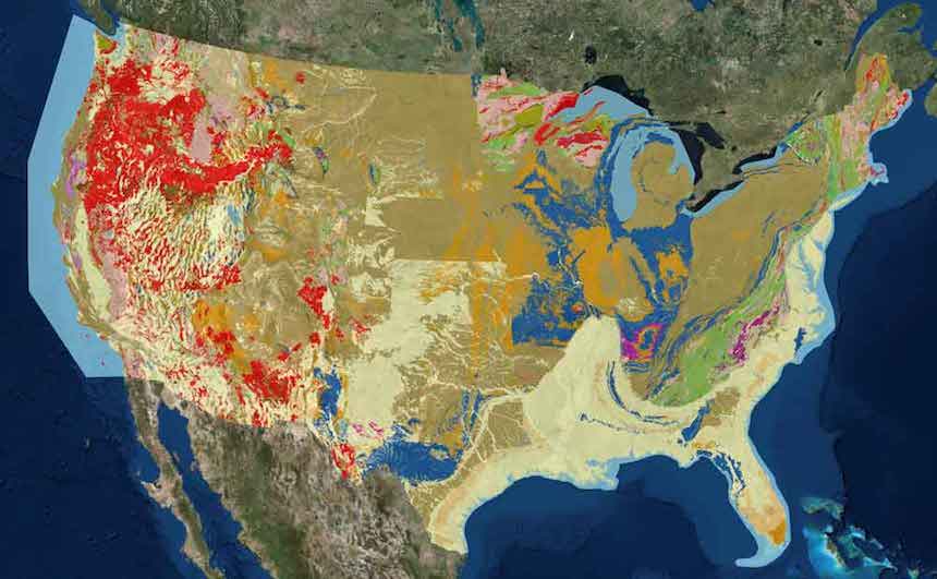
 The U.S. Geological Survey (USGS) has created the State Geological Map Compilation, which combines different geological maps of the lower 48 states to create a single, comprehensive source of geological geospatial data. USGS and many states collect and publish geological maps, however different geological surveys and different states use different terms to categorize geological features, making it difficult to combine these different resources. USGS converted the data from these sources into a standardized format to create the State Geological Map, making it easier for researchers to study mineral deposits, earthquake risk, and other geological issues across the United States.
Courtesy of Center for Data Innovation