A study by German scientists from Jena and Hamburg, published in the journal Nature, shows that artificial intelligence (AI) can substantially improve our understanding of the climate and the Earth system. Especially the potential of deep learning has only partially been exhausted so far. In particular, complex dynamic processes such as hurricanes, fire propagation, and vegetation dynamics can be better described with the help of AI. As a result, climate and Earth system models will be improved, with new models combining artificial intelligence and physical modeling.
In the past decades mainly static attributes have been investigated using machine learning approaches, such as the distribution of soil properties from the local to the global scale. For some time now, it has been possible to tackle more dynamic processes by using more sophisticated deep learning techniques. This allows for example to quantify the global photosynthesis on land with simultaneous consideration of seasonal and short term variations.

Deducing underlying laws from observation data
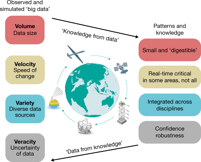
“From a plethora of sensors, a deluge of Earth system data has become available, but so far we’ve been lagging behind in analysis and interpretation”, explains Markus Reichstein, managing director of the Max Planck Institute for Biogeochemistry in Jena, directory board member of the Michael-Stifel-Center Jena (MSCJ) and first author of the publication. “This is where deep learning techniques become a promising tool, beyond the classical machine learning applications such as image recognition, natural language processing or AlphaGo”, adds co-author Joachim Denzler from the Computer Vision Group of the Friedrich Schiller University Jena (FSU) and member of MSCJ. Examples for application are extreme events such as fire spreads or hurricanes, which are very complex processes influenced by local conditions but also by their temporal and spatial context. This also applies to atmospheric and ocean transport, soil movement, and vegetation dynamics, some of the classic topics of Earth system science.
Artificial intelligence to improve climate and Earth system models
However, deep learning approaches are difficult. All data-driven and statistical approaches do not guarantee physical consistency per se, are highly dependent on data quality, and may experience difficulties with extrapolations. Besides, the requirement for data processing and storage capacity is very high. The publication discusses all these requirements and obstacles and develops a strategy to efficiently combine machine learning with physical modeling. If both techniques are brought together, so-called hybrid models are created. They can for example be used for modeling the motion of ocean water to predict sea surface temperature. While the temperatures are modelled physically, the ocean water movement is represented by a machine learning approach. “The idea is to combine the best of two worlds, the consistency of physical models with the versatility of machine learning, to obtain greatly improved models”, Markus Reichstein further explains.
The scientists contend that detection and early warning of extreme events as well as seasonal and long-term prediction and projection of weather and climate will strongly benefit from the discussed deep-learning and hybrid modelling approaches.
